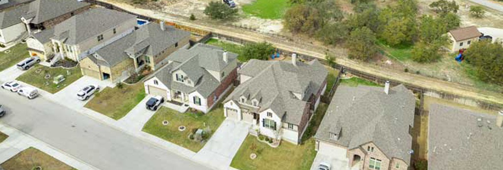
Real Estate
Whether you're selling a single-family home, managing a housing community, or planning an entire development, Peak City Drone has the tools and expertise to help. Contact us today for a custom quote and let’s take your residential real estate project to new heights.
Commercial Drone Services
With years of aerial experience, a trusted local presence in Apex, NC, and top-tier drone equipment, Peak City Drone is your go-to partner for commercial drone services across North Carolina. We bring experience, precision, and professional integrity to every job — from inspections to marketing visuals to detailed site surveys.
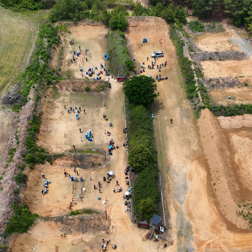
Land Mapping Services
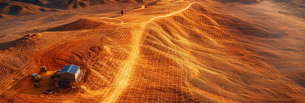
Traditional land surveys can take days or even weeks, especially across rugged or remote terrain. Drone mapping reduces this to just hours, delivering high-resolution data with rapid turnaround. This not only saves time but also reduces costs associated with labor, travel, and equipment.
Residential & Commercial Drone Services
Peak City Drone in Apex, NC offers professional drone services tailored for real estate, construction, and telecommunications. From high-resolution aerial photography for commercial and residential listings to detailed photogrammetry, LiDAR, and thermal inspections of cell towers, we provide accurate, FAA-compliant drone data. Our skilled team also supports land mapping, aerial surveying, and emergency search and rescue operations, making us a reliable partner for any aerial project.
CERT#5143416
sUAS PILOT
Drones
From search and rescue to industrial inspections, the Matrice 350 RTK Commercial Drone with LIDAR is equipped to map dense foulage and detailed infrastructure inspections. Making it easy to identify damage, wear, or potential hazards
Technology
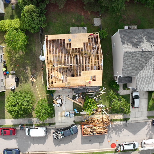
Specializing in high-precision drone mapping for construction sites, delivering centimeter-level accuracy for digital twins, progress tracking, and site planning. Our aerial data helps project managers make smarter decisions, reduce rework, and keep timelines on track — all from a bird’s-eye view.
Eco-Friendly
We’re proud to offer a more sustainable approach to site inspection, land mapping, and data collection. By using drones, we reduce the need for heavy machinery, minimize ground disruption, and lower fuel emissions — all while capturing accurate, actionable data from the air. It’s a smarter, greener way to get the job done.
Faq
Frequently Asked Questions
Frequently asked questions regarding drone services and the technology used by Peak City Drone.
No — you don’t need to worry about permits or paperwork. Our FAA-certified pilots at Peak City Drone Company handle all necessary airspace approvals, flight planning, and regulatory compliance. If your site is in controlled airspace or near an airport, we’ll secure the proper authorizations for a safe and legal flight.
Most jobs — like real estate photography or basic mapping — can be completed within an hour on site, with final deliverables ready in 1 to 3 business days. Projects involving inspections, 3D modeling, or large-scale mapping may take longer. We’ll always give you a time estimate up front.
We use advanced, commercial-grade drones outfitted with:
-
- 4K Cameras – Ultra high-definition video and stills for stunning clarity.
- We use the latest RTK (real time kinematics) technology to ensure centimeter data collection.
-
- LiDAR (Light Detection and Ranging) – A remote sensing method that uses laser light to measure distances and create accurate 3D maps, even through dense vegetation.
- Thermal Imaging – Detects heat signatures for finding leaks, equipment faults, or even people during search and rescue operations.
- Photogrammetry – A technique that uses photos taken from multiple angles to create accurate measurements and 3D models of land or structures.
Yes, absolutely — as long as it’s done safely and within FAA rules. We fly in residential areas, near construction sites, and around buildings using safety protocols and real-time obstacle sensors. We also respect privacy boundaries and can alert nearby residents or property owners if needed.
We work with a variety of clients, including:
Realtors and Brokers – Showcase homes and properties with aerial views.
Construction and Developers – Monitor job progress, track materials, and plan site layout.
City and Local Governments – Assist with zoning, inspections, and infrastructure planning.
Property Managers – Inspect large apartment complexes or HOAs without lifts or scaffolding.
Landowners and Hunters – Use drone mapping to survey terrain, vegetation, and animal movement.
Telecom and Utilities – Inspect towers, rooftops, and high-up infrastructure safely.
Emergency Services – Assist in search and rescue with thermal and real-time video.
Trusted by Professionals. Powered by Precision. Get Your Custom Quote Today.
Peak City Drone Blog
Measuring Biomass with Drones: How Accurate Can You Get?
Managing wood chip stockpiles is tough—irregular shapes and density swings make accuracy difficult. With DJI’s Zenmuse L2 LiDAR, D-RTK 3, and…
How Drones Are Transforming Real Estate Listings
Drones boost real estate sales by 68%, attract 4× more buyer inquiries, and help listings sell faster and for more—transforming property……
LiDAR and Drone Technology: Mapping the World in 3D
Learn how LiDAR drones deliver fast, high-precision 3D mapping for surveying, construction, forestry, archaeology, and environmental monitoring.